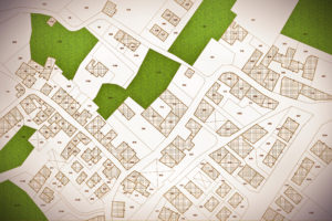
A plat map is one of the most valuable items a property owner can have. It provides a detailed, scaled drawing that outlines your property boundaries, neighboring lots, streets, and easements.
Whether you are buying land, planning construction, resolving a boundary issue, or simply verifying your property’s layout, having an accurate plat map is essential.
Understanding how to obtain a plat map can save you time and potential legal complications. This article will walk you through what a plat map is, where to find it, how to access it through local and online resources, and when you might need the help of a professional surveyor.
Understanding What a Plat Map Shows
Before you begin your search, it is important to understand what a plat map actually shows and why it matters. A plat map is a recorded map of land divisions within a specific area that is often created when a subdivision is first established.
It provides essential information such as the following.
Property boundaries and dimensions
Lot numbers or parcel identification numbers (PINs)
Easements for utilities, drainage, or access
Roads and rights-of-way adjacent to the property
Public spaces or common areas in a subdivision
While a survey provides precise, on-the-ground measurements of your specific property, a plat map offers a broader overview of how your land fits within the neighborhood or subdivision. It helps verify property ownership and clarify any boundary or easement concerns.
Accurate plat maps are vital for real estate transactions, zoning applications, land development, and home improvements. They ensure that all parties involved have a clear understanding of property boundaries and legal divisions.
Checking Local Government Resources
The easiest way to start looking for your plat map is by contacting local government offices. Most counties and municipalities keep official plat maps as part of their land and property records.
County Assessor Office: This is usually the first place to check. The assessor maintains property records for taxation purposes and often has digital or printed plat maps available. You can visit in person, call, or check their website.
Planning or Zoning Department: These offices manage land-use planning and subdivision approvals. They may have copies of the recorded plats, especially for newer developments.
Online Property Record Databases: Many local governments now offer online property search tools or GIS (Geographic Information System) portals where you can view and print plat maps for free.
Each county system is different, but typically you’ll need your parcel number, property address, or owner’s name to search for your plat. Checking your local government website can help you determine whether these records are available online or require an in-person visit.
Visiting the County Recorder or Clerk Office
If you cannot find your plat map online, your next step is to visit the county recorder office (sometimes called the county clerk or registrar of deeds). This office keeps official records of land transactions, including plats, deeds, and easements.
The following are the general steps involved with obtaining a plat map from the recorder office:
1) Locate the correct office: Determine whether your county recorder or clerk handles plat records. You can find this information on the official county website.
2) Prepare property details: Bring your property address, parcel ID number, or legal description to help staff locate the correct record.
3) Submit a request: You can request a copy of the recorded plat map either in person or, in some cases, through the mail or online request form.
4) Pay applicable fees: Some offices charge small fees for printed or certified copies of plat maps.
Obtaining the map directly from the county ensures that you receive the official, legally recorded version, which is especially important for real estate transactions or legal purposes.
Using Online Tools and GIS Mapping Services
Many property owners can access plat maps from the comfort of their home through online GIS mapping tools.
Geographic Information Systems (GIS) are interactive, digital maps that display land parcels, boundaries, and property data. Most counties have GIS websites that are free to access and easy to navigate.
Here are the general steps for using a GIS.
1) Visit the county assessor or GIS website.
2) Enter your property address, parcel ID, or owner name in the search bar.
3) View your property on the interactive map, where you can often see boundaries, lot dimensions, and neighboring parcels.
4) Download or print a plat-style map directly from the website.
GIS can offer quick and convenient access from anywhere with the ability to layer additional information, such as flood zones, zoning districts, or tax parcels.
Online GIS tools are excellent for research, planning, or general reference, but you should confirm boundary details with official or surveyed plans when accuracy is critical.
Hiring a Professional Surveyor (If Needed)
If your property is not part of a recorded subdivision or if existing maps are outdated, you may need to hire a licensed land surveyor to create or verify your plat map.
A surveyor can 1) measure the exact boundaries for your property using modern equipment, 2) identify encroachments, easements, and improvements, and 3) prepare a new plat map or verify an existing one for legal filing.
The following are cases when you might need to hire a surveyor.
!) You are buying or selling property and need an updated boundary confirmation.
2) You are planning construction or land development that may affect property lines.
3) Your property lacks an existing plat or is located in a rural or unplatted area.
Conclusion
Obtaining a plat map of your property is a simple yet essential step in understanding your land and protecting your investment. Whether you access it through your local government office, county recorder, online GIS system, or a licensed surveyor, having an accurate plat map can help you make informed decisions about your property.
Plat maps are valuable tools for homeowners, developers, and real estate professionals alike. They ensure transparency in property transactions, prevent boundary disputes, and aid in planning improvements or developments.


