
A graphic scale is a visual representation of distance that appears as a line or bar, divided into segments, showing the relationship between distances on…

A topographic survey is a detailed measurement of the elevation and surface features of a piece of land. It captures both natural and man-made elements,…

A topographic survey is a detailed measurement of the natural and man-made features of a piece of land, focusing primarily on elevation and surface characteristics.…
A topographic map is one of the most valuable tools for anyone who needs to understand the shape and elevation of the land such as…
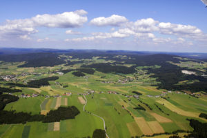
Topography is a fundamental concept in geography, earth science, and land-related professions. It refers to the arrangement of natural and man-made features on the surface…
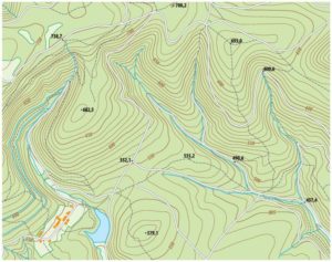
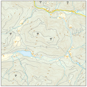
Contour lines are one of the most important features on a topographic map. They provide a visual way to represent the shape of the land,…
A graphic scale, sometimes called a bar scale, is a visual tool used on maps, site plans, engineering drawings, and architectural layouts to show the…
A topographic map is one of the most detailed and informative tools used to understand the surface of the Earth. A topographic map reveals not…

When land is divided into smaller lots for development, one of the most important legal steps in the process is preparing and filing a subdivision…

A plat map is one of the most valuable items a property owner can have. It provides a detailed, scaled drawing that outlines your property…