Topography is a fundamental concept in geography, earth science, and land-related professions. It refers to the arrangement of natural and man-made features on the surface of the Earth, including variations in elevation, slope, and landforms.
Understanding topography is essential because it influences how land is used, developed, and managed. From building roads and cities to managing natural resources and navigating outdoor environments, topography plays a central role in decision-making across many fields.
This article explains what topography is, the elements that define it, how it is represented, and why it is so important in both natural and human-made environments.
Key Elements of Topography
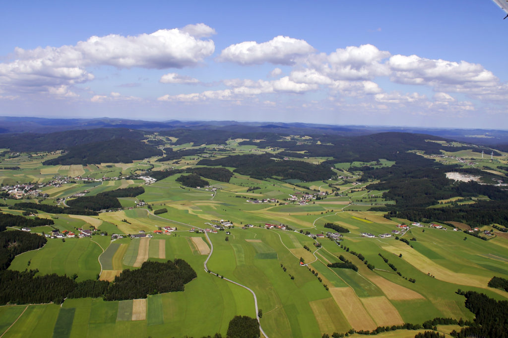
Topography is defined by several key elements that describe the shape and structure of the Earth’s surface. One of the most important elements is elevation, which refers to the height of a point on the land relative to sea level. Differences in elevation create hills, mountains, valleys, and plains.
Another essential element is relief, which describes the difference in elevation between the highest and lowest points in an area. Areas with high relief, such as mountainous regions, have dramatic elevation changes, while areas with low relief, such as coastal plains, are relatively flat.
Landforms are also central to topography. Natural features like mountains, ridges, valleys, plateaus, and basins define the physical character of a region. Together, elevation, relief, and landforms provide a complete picture of how the Earth’s surface is shaped.
How Topography Is Represented
Topography is most commonly represented through topographic maps, which use contour lines to show elevation changes. Each contour line connects points of equal elevation, allowing a flat map to represent three-dimensional terrain. The spacing between contour lines indicates slope steepness, with closely spaced lines showing steep terrain and widely spaced lines indicating gentle slopes.
In addition to contour lines, topographic maps use symbols, colors, and shading to represent features such as rivers, roads, vegetation, and buildings. A map’s scale and legend help users interpret distances and elevations accurately.
Modern technology has expanded how topography is represented. Digital elevation models (DEMs), satellite imagery, and geographic information systems (GIS) allow for highly detailed, interactive, and three-dimensional views of terrain, making topographic data more accessible and precise than ever before.
Factors That Shape Topography
The Earth’s topography is shaped by a combination of geological, climatic, and human factors. Geological processes such as tectonic plate movement, volcanic activity, and earthquakes create mountains, faults, and other large-scale landforms.
Weathering and erosion also play major roles in shaping topography over time. Water, wind, ice, and gravity gradually break down rocks and transport sediment, carving valleys, shaping coastlines, and smoothing landscapes.
Human activities can significantly alter natural topography as well. Construction, mining, agriculture, and land development reshape the land by grading surfaces, filling low areas, and cutting into hillsides.
Importance of Topography in Practical Applications
Topography is critically important in land development, engineering, and construction. Before any building project begins, professionals analyze topography to determine slope stability, drainage patterns, and suitable building locations.
In environmental management, topography influences water flow, soil erosion, and habitat distribution. It plays a key role in assessing natural hazards such as floods, landslides, and wildfires, helping communities plan for and mitigate risks.
Topography is also essential in agriculture, transportation, and land planning. Farmers use topographic data to manage irrigation and soil conservation, while planners use it to design efficient transportation networks and sustainable cities.
Topography Versus Related Concepts
Topography is often confused with related terms such as geography and terrain. While geography is a broad field that studies both physical and human aspects of the Earth, topography focuses specifically on surface features and elevation.
Terrain is a closely related concept that generally refers to the physical characteristics of the land, especially as they affect movement or use. Topography provides a more detailed and measurable description of terrain, often using maps and data.
Topography is also closely tied to land surveying and cartography. Surveyors measure elevations and land features, while cartographers represent that information on maps. Together, these disciplines ensure accurate representation and understanding of the Earth’s surface.
Conclusion
Topography describes the shape, elevation, and features of the Earth’s surface, offering essential insights into how land looks and functions.
Recognizing the importance of topography helps individuals and professionals alike make informed decisions as they relate to both the natural environment and the needs of human society.