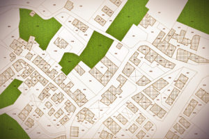
When dealing with real estate, land development, or property transactions, two terms often arise: plat and survey. They might seem interchangeable since both involve maps…

Note: “The Land Development Site” is a participant in the Amazon Associates Program. As an Amazon Associate, “The Land Development Site” earns a referral fee…

When designing either the intersection of a driveway entrance with a road or the intersection of two roads, consideration should be given to the sight…

A zoning table is a chart found in a land development plan that summarizes the various local zoning ordinance requirements of the project and is…

A riparian buffer is a zone designated on a land development plan that is located along a waterway and that is comprised of vegetation that…

Wetlands are ground areas that frequently stay inundated with water after rainfall events. These areas are usually wet and characterized by the presence of vegetation…

A topographic map can provide a large amount of valuable information if it is used properly. The following are six steps for how to properly…

A part of a land development drawing is the legend which is the rectangular chart (usually found on the cover sheet and in one of…

A grading plan is a construction plan that shows a site contractor how to grade a new land development project. It shows what areas of…

A title block is the rectangular area of information in a land development plan set that identifies various pieces of the project and the plan.…